GB/T 38028-2019 PDF EnglishUS$150.00 · In stock · Download in 9 seconds
GB/T 38028-2019: Gradation standard for panchromatic data products of remote sensing satellites Delivery: 9 seconds. True-PDF full-copy in English & invoice will be downloaded + auto-delivered via email. See step-by-step procedure Status: Valid
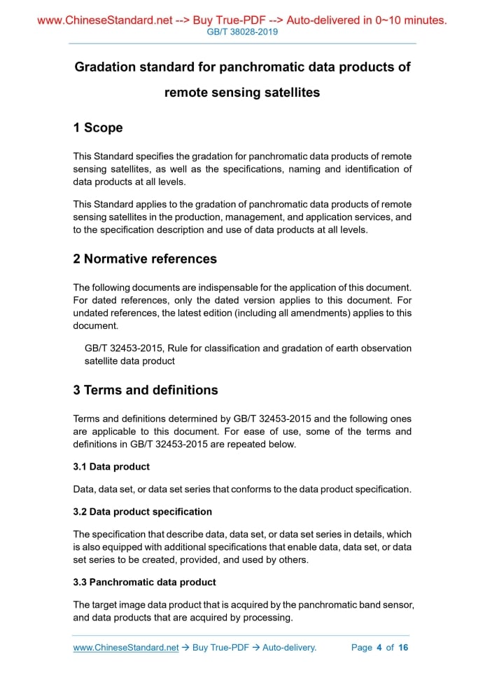
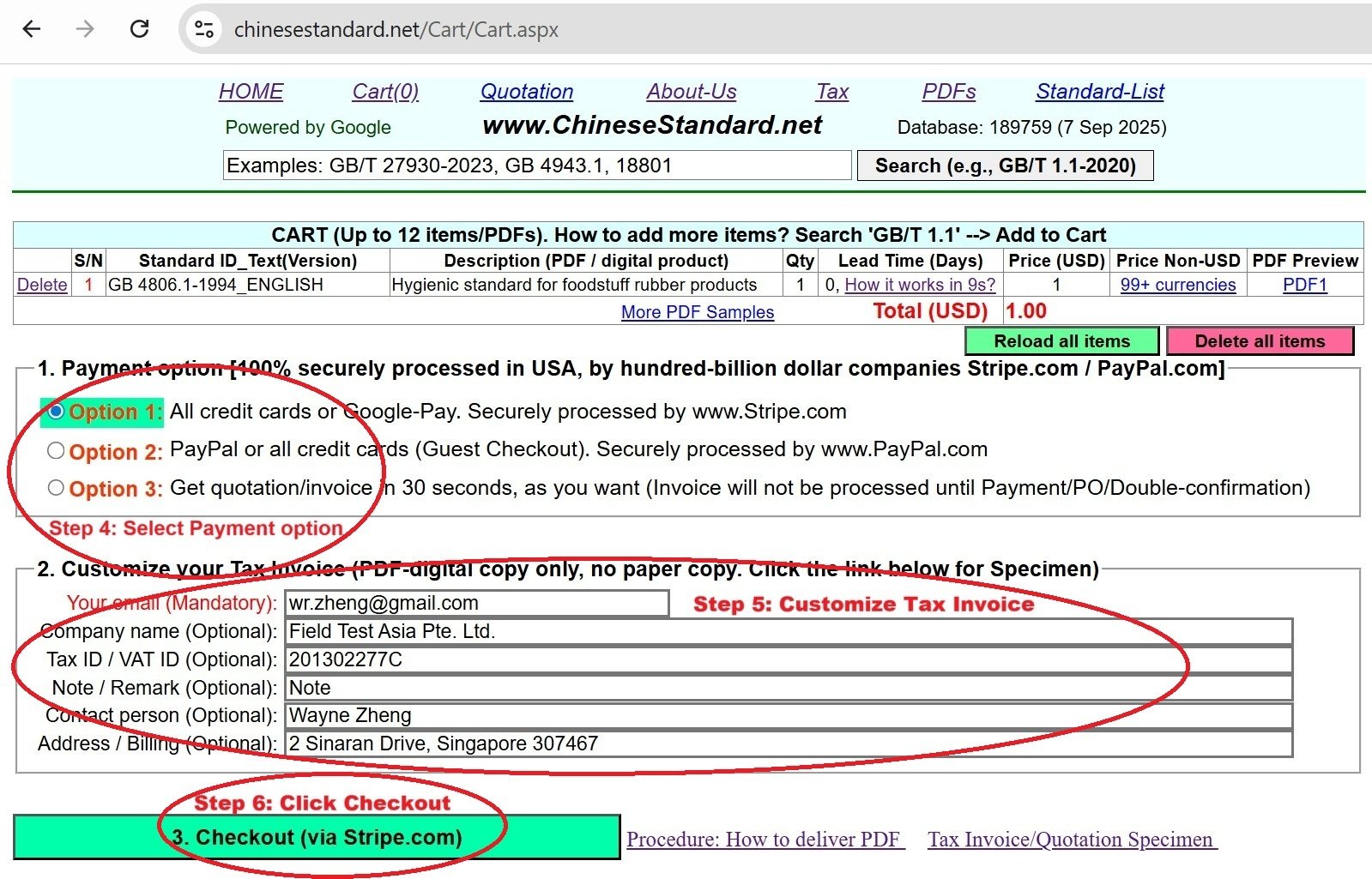
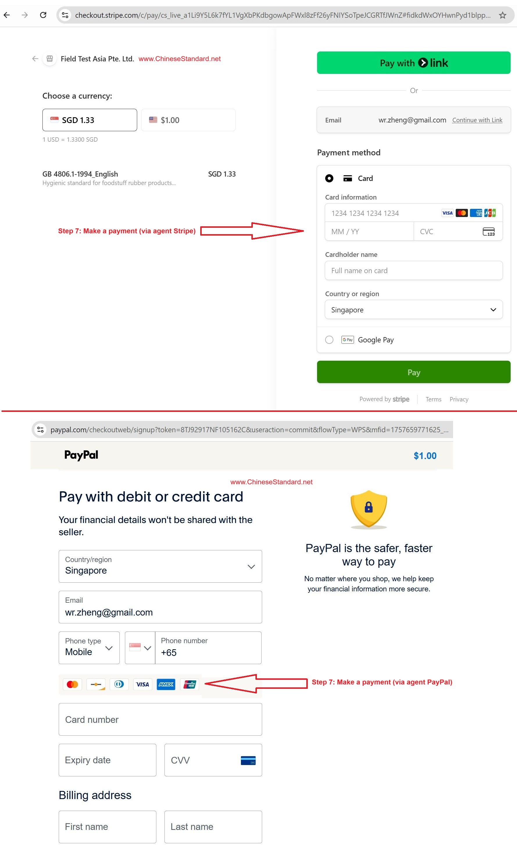
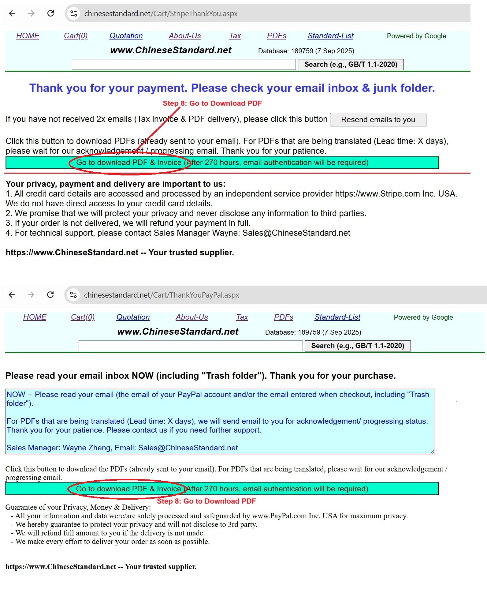
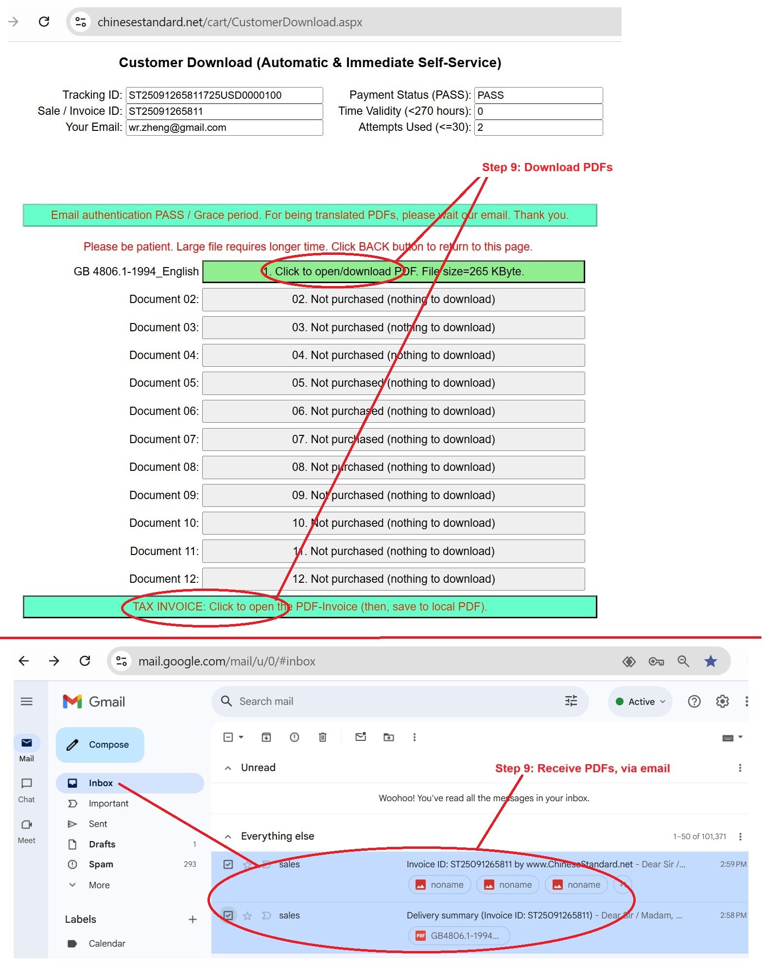
Similar standardsGB/T 38028-2019: Gradation standard for panchromatic data products of remote sensing satellites---This is an excerpt. Full copy of true-PDF in English version (including equations, symbols, images, flow-chart, tables, and figures etc.), auto-downloaded/delivered in 9 seconds, can be purchased online: https://www.ChineseStandard.net/PDF.aspx/GBT38028-2019NATIONAL STANDARD OF THE PEOPLE’S REPUBLIC OF CHINA ICS 49.020 V 09 Gradation standard for panchromatic data products of remote sensing satellites ISSUED ON: AUGUST 30, 2019 IMPLEMENTED ON: MARCH 01, 2020 Issued by: State Administration for Market Regulation; Standardization Administration of the People’s Republic of China. Table of ContentsForeword ... 3 1 Scope ... 4 2 Normative references ... 4 3 Terms and definitions ... 4 4 Abbreviations ... 5 5 Gradation ... 5 6 Data product specifications ... 8 7 Naming and identification of data products at all levels ... 9 Appendix A (Informative) Recommended indicators for panchromatic data products at all levels of remote sensing satellites ... 10 Appendix B (Informative) Calculation method of related indicators of panchromatic data products of remote sensing satellites ... 13 Gradation standard for panchromatic data products of remote sensing satellites1 ScopeThis Standard specifies the gradation for panchromatic data products of remote sensing satellites, as well as the specifications, naming and identification of data products at all levels. This Standard applies to the gradation of panchromatic data products of remote sensing satellites in the production, management, and application services, and to the specification description and use of data products at all levels.2 Normative referencesThe following documents are indispensable for the application of this document. For dated references, only the dated version applies to this document. For undated references, the latest edition (including all amendments) applies to this document. GB/T 32453-2015, Rule for classification and gradation of earth observation satellite data product3 Terms and definitionsTerms and definitions determined by GB/T 32453-2015 and the following ones are applicable to this document. For ease of use, some of the terms and definitions in GB/T 32453-2015 are repeated below. 3.1 Data product Data, data set, or data set series that conforms to the data product specification. 3.2 Data product specification The specification that describe data, data set, or data set series in details, which is also equipped with additional specifications that enable data, data set, or data set series to be created, provided, and used by others. 3.3 Panchromatic data product The target image data product that is acquired by the panchromatic band sensor, and data products that are acquired by processing. Data products that use ground control points for geometric fine correction on the basis of L0 ~ L2 data; it can be divided into 3 sub-levels according to the degree of radiometric correction processing: -- L3-1: panchromatic data products of remote sensing satellites that have undergone geometric fine correction and no radiometric correction; -- L3-2: panchromatic data products of remote sensing satellites that have undergone geometric fine correction and relative radiometric correction; -- L3-3: panchromatic data products of remote sensing satellites that have undergone geometric fine correction and absolute radiometric correction. L3 products shall meet the corresponding indicator requirements, and can be expanded or adjusted according to specific conditions. Refer to Appendix A for each indicator; refer to Appendix B for specific algorithms. 5.6 L4 product Data products that use ground control points and digital elevation model for geometric terrain correction on the basis of L0 ~ L3 data; it can be divided into 3 sub-levels according to the degree of radiometric correction processing: -- L4-1: panchromatic data products of remote sensing satellites that have undergone geometric terrain correction and no radiometric correction; -- L4-2: panchromatic data products of remote sensing satellites that have undergone geometric terrain correction and relative radiometric correction; -- L4-3: panchromatic data products of remote sensing satellites that have undergone geometric terrain correction and absolute radiometric correction. L4 products shall meet the corresponding indicator requirements, and can be expanded or adjusted according to specific conditions. Refer to Appendix A for each indicator; refer to Appendix B for specific algorithms. 5.7 L5 product Data products that have other geographic information or navigation and positioning information to participate in the representation, on the basis of L1 ~ L4 data. The radiation and geometric accuracy of L5 products shall meet the corresponding L1 ~ L4 product accuracy requirements. 5.8 L6 product Record the imaging geometry model parameter information of the image product; it is used to construct the conversion model between the image point position and the corresponding planimetric point position of the image. 6.4 Metadata file The metadata file shall contain the product metadata items that are specified in this Standard; other information extension items can be determined according to user needs. The basic content is as follows: a) data product identification information; b) data product coordinate reference system information; c) data product quality information; d) data product content information; e) data product acquisition information; f) data product distribution information. 6.5 Thumbnail file Browse image that stores the low resolution that is generated by resampling image files.7 Naming and identification of data products at alllevels The naming of panchromatic data products of remote sensing satellites shall be implemented in accordance with the provisions of GB/T 32453-2015.Appendix B(Informative) Calculation method of related indicators of panchromatic data products of remote sensing satellites B.1 Radiometric correction accuracy test method B.1.1 Relative radiometric correction uncertainty Generally, use the products that are processed by relative radiometric correction to calculate the generalized noise, which serves as the indicator to evaluate the relative radiometric correction uncertainty. The test methods and steps are as follows: a) Select a number of L1 product images that contain uniform ground objects after radiometric correction; b) Select uniform sub-images of m rows and n columns (m≥300, n≥300) from images of several brightness types; c) For the selected kth image, first calculate the mean value (Avgk) of the image; then, calculate the absolute error (Ek) and relative error (REk) of the column pixel DN value; d) Calculate the relative radiometric uncertainty (E) of the pixels in which all sub-images are located. The calculation of the average (Avgk) of the images is shown in Formula (B.1). Where: Avgk -- average of the images; DNkij -- image brightness value; m -- row number; n -- column number. The calculation of the absolute error (Ek) of the pixel DN value is shown in Formula (B.2). ......Source: Above contents are excerpted from the full-copy PDF -- translated/reviewed by: www.ChineseStandard.net / Wayne Zheng et al. Tips & Frequently Asked Questions:Question 1: How long will the true-PDF of English version of GB/T 38028-2019 be delivered?Answer: The full copy PDF of English version of GB/T 38028-2019 can be downloaded in 9 seconds, and it will also be emailed to you in 9 seconds (double mechanisms to ensure the delivery reliably), with PDF-invoice.Question 2: Can I share the purchased PDF of GB/T 38028-2019_English with my colleagues?Answer: Yes. The purchased PDF of GB/T 38028-2019_English will be deemed to be sold to your employer/organization who actually paid for it, including your colleagues and your employer's intranet.Question 3: Does the price include tax/VAT?Answer: Yes. Our tax invoice, downloaded/delivered in 9 seconds, includes all tax/VAT and complies with 100+ countries' tax regulations (tax exempted in 100+ countries) -- See Avoidance of Double Taxation Agreements (DTAs): List of DTAs signed between Singapore and 100+ countriesQuestion 4: Do you accept my currency other than USD?Answer: Yes. www.ChineseStandard.us -- GB/T 38028-2019 -- Click this link and select your country/currency to pay, the exact amount in your currency will be printed on the invoice. Full PDF will also be downloaded/emailed in 9 seconds.How to buy and download a true PDF of English version of GB/T 38028-2019?A step-by-step guide to download PDF of GB/T 38028-2019_EnglishStep 1: Visit website https://www.ChineseStandard.net (Pay in USD), or https://www.ChineseStandard.us (Pay in any currencies such as Euro, KRW, JPY, AUD).Step 2: Search keyword "GB/T 38028-2019". Step 3: Click "Add to Cart". If multiple PDFs are required, repeat steps 2 and 3 to add up to 12 PDFs to cart. Step 4: Select payment option (Via payment agents Stripe or PayPal). Step 5: Customize Tax Invoice -- Fill up your email etc. Step 6: Click "Checkout". Step 7: Make payment by credit card, PayPal, Google Pay etc. After the payment is completed and in 9 seconds, you will receive 2 emails attached with the purchased PDFs and PDF-invoice, respectively. Step 8: Optional -- Go to download PDF. Step 9: Optional -- Click Open/Download PDF to download PDFs and invoice. See screenshots for above steps: Steps 1~3 Steps 4~6 Step 7 Step 8 Step 9 |